

Machine Learning for Remote Sensing
This workshop promotes trans-disciplinary research through diverse view-points to tackle the pressing questions of our times, such as climate change, social inequalities, biodiversity, and food security. Developing modern machine learning approaches tailored towards remote sensing data is key to investigating these problems efficiently. This third Machine Learning for Remote Sensing (ML4RS) workshop promotes this exchange by allowing researchers to present their research on environmentally and societally important applications and/or innovative methods that can have an impact in such application domains.
Topics
We solicit research papers addressing advancements in key topics in Machine Learning for Remote Sensing, such as domain adaptation, concept drift, out-of-distribution detection, evaluation using unlabeled data, model architectures for remote sensing data, semi-supervised learning, unsupervised learning, self-supervised learning, multi-fidelity data fusion, federated learning, data-centric AI, human-in-the-loop and active learning, machine learning for time series, methods for learning from limited labeled data (e.g., few-shot learning, meta-learning), new benchmark datasets involving remote sensing data, geographic equity, and fairness.
We welcome applications related to sustainable development, societal needs, planetary exploration, and more, including but not limited to agriculture and food security, forestry, biodiversity and species distribution modeling, natural hazards and disasters, and other societal and environmental questions.
Papers can present methodological innovations designed towards a particular problem or can also apply existing methods when they highlight new perspectives or limitations on existing methods or the broader environmental and societal applicability through a particular dataset or impact area.
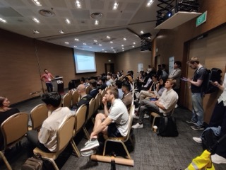
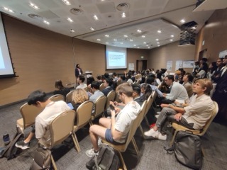
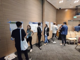
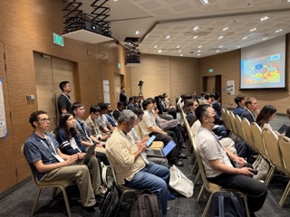
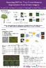
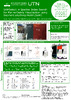
Photos & Impressions
The workshop took place in Singapore on May April 27th 2025. Here are some impressions from the Venue.
 |
 |
 |
 |
🗓 Schedule
Event times shown in the schedule are local times in Singapore
| Time | Topic |
|---|---|
| 9:00–9:10 | Opening Remarks |
| 9:10–9:40 | Keynote 1 Stefano Ermon (Stanford University) |
| 9:40–10:00 | Invited Talk 1 Hao Li (National University of Singapore) |
| 10:00–10:30 | Coffee Break |
| 10:30–10:50 | Invited Talk 2 Soo Chin Liew (National University of Singapore) |
| 10:50–11:20 | 2x Contributed Oral Talks 1 |
| 11:20–12:00 | Poster Session #1 |
| 12:00–14:00 | Lunch Break |
| 14:00–14:30 | Keynote 2 Xiaoxiang Zhu (Technical University of Munich) |
| 14:30–15:00 | 2x Contributed Oral Talks 2 |
| 15:00–15:30 | Coffee Break |
| 15:30–15:50 | Invited Talk 3 Konstantin Klemmer (Microsoft) |
| 15:50–16:20 | 2x Oral Talks 3 |
| 16:20–17:00 | Poster Session #2 |
| 17:00–17:20 | Best Paper Awards, Closing Remarks |
🎉 Awards
Thanks to our sponsors , we could award the best student paper and best paper.
| Best Paper Award 🏆 | Best Student Paper Award 🏆 |
|---|---|
| Tackling Few-Shot Segmentation in Remote Sensing via Inpainting Diffusion Model. Steve Immanuel; Woojin Cho; Junhyuk Heo; Darongsae Kwon (TelePIX) | Using Multiple Input Modalities Can Improve Data-efficiency for ML with Satellite Imagery. Arjun Rao; Esther Rolf (University of Colorado Boulder). |
 |
 |
Orals
Oral Talks 1 (10:50–11:20)
- A Recipe for Improving Remote Sensing VLM Zero Shot Generalization. Aviad Barzilai (Google); Yotam Gigi (google); Vered Silverman (google); YEHONATHAN REFAEL (Google)*; Bolous Jaber (google); Amr Helmy (google); Tomer Shekel (google); George Leifman (google); Genady Beryozkin (google)
- Using Multiple Input Modalities Can Improve Data-efficiency for ML with Satellite Imagery. Arjun Rao (The University of Colorado Boulder)*; Esther Rolf (University of Colorado Boulder). [poster]
Oral Talks 2 (14:30 - 15:00)
- Balancing Quantity and Representativeness in Constrained Geospatial Dataset Design. Betti, Livia*; Rolf, Esther. [poster]
- Do Satellite Tasks Need Special Pretraining?. Ani Vanyan (YerevaNN); Alvard Barseghyan (YerevaNN); Hakob Tamazyan (YerevaNN); Tigran Galstyan (YerevaNN); Vahan Huroyan (YerevaNN); Hrant Khachatrian (YerevaNN)*
Oral Talks 3 (15:50 - 16:20)
- Tackling Few-Shot Segmentation in Remote Sensing via Inpainting Diffusion Model. Steve Immanuel; Woojin Cho; Junhyuk Heo; Darongsae Kwon (all TelePIX)
- OSDMamba: Enhancing Oil Spill Detection from Synthetic Aperture Radar Images Using Selective State Space Model. Chen, Shuaiyu*; Wang, Fu; Ren, Peng; Luo, Chunbo; Fu, Zeyu
Posters (Sessions 1 and 2)
- [poster] Self-supervised Object Detection in Synthetic Aperture Radar Images. Yasin Almalioglu; Andrzej Kucik; Geoff French; Dafni Antotsiou; Alexander Adam; Cédric Archambeau
- Zero-Shot Tree Detection and Segmentation from Aerial Forest Imagery. Michelle Chen; David Russell; Amritha Pallavoor; Derek Young; Jane Wu
- A Recipe for Improving Remote Sensing VLM Zero Shot Generalization. Aviad Barzilai; Yotam Gigi; Vered Silverman; Yehonathan Refael; Bolous Jaber; Amr Helmy; Tomer Shekel; George Leifman; Genady Beryozkin
- Leveraging Satellite Imagery for Childhood Poverty Estimation. Fan Yang; Makkunda Sharma; Duy-Nhat Vo; Jack Gidney; Matthew Sutcliffe; Mengyan Zhang; Juliette Unwin; Esra Suel; Swapnil Mishra; Samir Bhatt; Oliver Fiala; William Rudgard; Seth Flaxman
- Interactive Few-shot Online Adaptation for User-Guided Segmentation in Aerial Images. Yeongsu Lee; Haeyun Lee; Kyungsu Lee
- [poster] PyViT-FUSE: A Foundation Model for Multi-Sensor Earth Observation Data. Manuel Weber; Carly Beneke
- Monitoring Illicit Rare Earth Mining in Myanmar via Self-Supervised Learning. Ollie Ballinger
- DR-SCAN: An Interpretable Dual-Branch Residual Spatial and Channel Attention Network for Remote Sensing and Geoscience Image Super-Resolution. Suraj Neelakantan; Martin Längkvist; Amy Loutfi
- DEAL-YOLO: Drone-based Efficient Animal Localization using YOLO. Aditya Naidu; Hem Gosalia; Ishaan Gakhar; Shaurya Rathore; Krish Didwania; Ujjwal Verma
- [poster] Using Multiple Input Modalities Can Improve Data-Efficiency for ML with Satellite Imagery. Arjun Rao; Esther Rolf
- Robustness to Geographic Distribution Shift using Location Encoders. Ruth Crasto
- [poster] An Analysis of Multimodal Large Language Models for Object Localization in Earth Observation Imagery. Darryl Hannan; John Cooper; Dylan White; Henry Kvinge; Timothy Doster; Yijing Watkins
- LIGHTHOUSE: Fast and Precise Distance to Shoreline Calculations from Anywhere on Earth. Patrick Beukema; Henry Herzog; Yawen Zheng; Favyen Bastani
- Onboard Terrain Classification via Stacked Intelligent Metasurface-Diffractive Deep Neural Networks from SAR Level-0 Raw Data. Mengbing Liu; Xin Li; Jiancheng An; Chau Yuen
- Tackling Few-Shot Segmentation in Remote Sensing via Inpainting Diffusion Model. Steve Immanuel; Woojin Cho; Junhyuk Heo; Darongsae Kwon
- [poster] Metadata, Wavelet, and Time Aware Diffusion Models for Satellite Image Super Resolution. Luigi Sigillo; Renato Giamba; Danilo Comminiello
- [poster] Assessing SAM for Tree Crown Instance Segmentation from Drone Imagery. Mélisande Teng; Arthur Ouaknine; Etienne Laliberté; Yoshua Bengio; David Rolnick; Hugo Larochelle
- LandsatQuake: A Large-Scale Dataset for Practical Landslide Detection. Vihaan Akshaay Rajendiran; Amanda Roeliza Hunt; Gen Li; Lei Li
- OSDMamba: Enhancing Oil Spill Detection from Synthetic Aperture Radar Images Using Selective State Space Model. Shuaiyu Chen; Fu Wang; Peng Ren; Chunbo Luo; Zeyu Fu
- Efficient Land-Cover Image Classification via Mixed Bit-Precision Quantization. Tushar Shinde; Ahmed Silima Vuai
- [poster] Predicting Out-of-Domain Performance under Geographic Distribution Shifts. Haoran Zhang; Konstantin Klemmer; Esther Rolf; David Alvarez-Melis
- [poster] Balancing Quantity and Representativeness in Constrained Geospatial Dataset Design. Livia Betti; Esther Rolf
- [poster] SAMSelect: A Spectral Index Search for Marine Debris Visualization Using Segment Anything. Joost van Dalen; Yuki Asano; Marc Russwurm
- Self-Supervised Representation Learning on Remote Sensing Pixel Time Series with Patch-Based Masking. Jackline Tum; Clinton Odour
- [poster] Large Language Models for Captioning and Retrieving Remote Sensing Images. Joao Silva; Joao Magalhaes; Devis Tuia; Bruno Martins
- Do Satellite Tasks Need Special Pretraining?. Ani Vanyan; Alvard Barseghyan; Hakob Tamazyan; Tigran Galstyan; Vahan Huroyan; Hrant Khachatrian
![[poster]](/iclr2025/camera_ready/posters/10_poster.jpg)
Keynote Speakers
- Stefano Ermon is an Associate Professor of Computer Science in the CS Department at Stanford University where he is affiliated with the Artificial Intelligence Laboratory. His research is centered on techniques for probabilistic modeling of data and is motivated by applications in the emerging field of computational sustainability. He has won several awards, including multiple Best Paper Awards, a NSF Career Award, ONR and AFOSR Young Investigator Awards, Microsoft Research Fellowship, Sloan Fellowship, and the IJCAI Computers and Thought Award. Stefano earned his Ph.D. in Computer Science at Cornell University in 2015.
- Xiaoxiang Zhu is Chair Professor for Data Science in Earth Observation at the Technical University of Munich (TUM), where she also serves as a director at the Munich Data Science Institute. She leads the national center of excellence ML4Earth and the international future AI lab AI4EO. Zhu is a visiting AI professor at ESA’s Phi-lab and a Fellow of IEEE, ELLIS, and Academia Europaea. Her main research interests are remote sensing and Earth observation, signal processing, machine learning and data science, with their applications in tackling societal grand challenges, e.g. Global Urbanization, UN’s SDGs and Climate Change.


Invited Speakers
- Hao Li is a Lecturer in GIS in the Department of Geography at the National University of Singapore (NUS). He received his PhD (Dr. rer. nat) from GIScience group, Heidelberg University, MS.c degree in Geomatics engineering, and double BS.c degrees in both Geographical Information Systems and Computer Science from Wuhan University, China. His recent research focuses on developing novel spatial representation learning methods with multimodal geospatial data for disaster management and urban analytics.
- Soo Chin Liew is a Principal Research Scientist (rank of Associate Professor) and Head of Research at the Center for Remote Imaging, Sensing and Processing (CRISP), National University of Singapore (NUS). He obtained his PhD degree in physics from the University of Arizona in 1989 and did post-doctoral research at the Physics Research Lab, University of California at San Francisco (UCSF) Radiology Department before joining NUS. He has previous research experience in thermoacoustic emission, X-ray transmission and single photon emission computed tomography, nuclear microscopy and image processing. His current research focuses on remote sensing of the earth with expertise in hyperspectral imaging, ocean optics, inland and coastal water quality, atmospheric aerosols, forest fires and land cover change. He is Associate Editor of Frontiers in Remote Sensing, Review Editor of Frontiers in Environmental Science, a member of the Editorial Board of Remote Sensing, and former Associate Editor of SPIE Journal of Applied Remote Sensing (2014 - 2019). He participated as a PI in NASA EO-1 satellite science team working on the Hyperion instrument.
- Konstantin Klemmer is a machine learning researcher at Microsoft Research Redmond. His research focuses broadly on applied AI and data-centric methods in organizational contexts and, more specifically, on the representation of geospatial phenomena in machine learning methods. Beyond that, Konstantin is interested in the application of these methods in urban environments and to tackle climate change. Before his current role, he was a postdoctoral researcher at Microsoft Research New England. Konstantin completed his PhD at the University of Warwick and New York University.


Organizers
- Hannah Kerner (Arizona State University)
- Marc Rußwurm (Wageningen University)
- Hamed Alemohammad (Clark University)
- Gedeon Muhawenayo (Arizona State University)
- Gabriel Tseng (McGill / Mila - Quebec AI institute)
- Ribana Roscher (Forschungszentrum Jülich)
- Ronny Hänsch (German Aerospace Center (DLR) / GRSS)
- Evan Shelhamer (Google DeepMind and University of British Columbia)
- Esther Rolf (University of Colorado, Boulder)
- Mirali Purohit (Arizona State University)
Program Committee
We thank the program committee for being available to review the submitted papers!
- Akram Zaytar (Microsoft)
- Alejandro Coca-Castro (The Alan Turing Institute)
- Anastasia Schlegel (DLR)
- Anna Jungbluth (European Space Agency)
- Anthony Fuller (Carleton University)
- Anthony Vodacek (Rochester Institute of Technology)
- Arthur Ouaknine (McGill University and Mila)
- Begum Demir (TU Berlin)
- Caleb Robinson (Microsoft AI for Good Research Lab)
- Camille Kurtz (Université Paris Cité)
- Caroline Gevaert (University of Twente)
- Charlotte Pelletier (Université de Bretagne du Sud)
- Christian Ayala (Tracasa Instrumental)
- Dalton Lunga (Oak Ridge National Laboratory)
- Dino Ienco (INRAE)
- Ellianna Abrahams (UC Berkeley)
- Gilberto Camara (INPE)
- Homa Ansari (ZEISS Meditec)
- Ioannis Athanasiadis (Wageningen University and Research)
- Jakob Gawlikowski (German Aerospace Center (DLR))
- Jan Dirk Wegner (University of Zurich)
- Javiera Castillo Navarro (Cnam)
- Jocelyn Chanussot (Grenoble Institute of Technology)
- Johannes Dollinger (University of Zurich)
- Johannes Jakubik (IBM Research)
- Jonathan Sullivan (University of Arizona)
- Keiller Nogueira (University of Liverpool)
- Kristof Van Tricht (VITO)
- Loic Landrieu (ENPC)
- Lukas Drees (University of Zurich)
- Marc Rußwurm (Wageningen University)
- Michael Mommert (Stuttgart University of Applied Sciences)
- Nicholas LaHaye (JPL)
- Paolo Fraccaro (IBM UK)
- Philipe Ambrozio Dias (Oak Ridge National Laboratory)
- Ragini Mahesh (German Aerospace Center - DLR)
- Raian Maretto (University of Twente)
- Ramesh Nair (Planet Labs PBC)
- Ritvik Sahajpal (University of Maryland)
- Roberto Interdonato (CIRAD)
- Sandeep Ravindra Tengali (Atlassian)
- Sarang Gupta (Columbia University)
- Steven Lu (Jet Propulsion Laboratory)
- Subit Chakrabarti (Cloud To Street)
- Sylvain Lobry (Université Paris Cité)
- Tanya Nair (Floodbase)
- Vishal Nedungadi (Wageningen University and Research)
- Wenwen Li (Arizona State University)
Call for Papers
Important Dates
Submission Deadline - February 10, 2025 (Anywhere on Earth)Acceptance Notification - March 3rd, 2025Travel Support Deadline - March 28th, 2025Camera Ready Submission Deadline - April 19, 2025 (Anywhere on Earth)Bonus Track Submission Deadline - April 23, 2025 (Anywhere on Earth)- Workshop - Sunday April 27th, 2025
Bonus Track
We invite content for a “bonus track” of our workshop to better broadcast projects, progress, and announcements across the diverse orbits of work on machine learning for remote sensing. In particular we welcome the submission of one-slide presentations and live demos. This is a first-time experiment to improve access so please join in.
Bonus track submission form: https://forms.gle/jPqYbQPgAhTi7RXA6
The deadline for the bonus track is April 23, 2025 (Anywhere on Earth).
Bonus slides will be auto-played during the poster sessions and are linked here for virtual attendees. Demos will be presented in-person during the event subject to venue space and equipment.
Travel Support
Thanks to our sponsors, we have limited funding available to support the travel of students to attend the workshop held at ICLR 2024. Awards are based on merit with additional consideration based on need and travel distance. Priority will be given to those whose papers are accepted for presentation at the workshop.
The deadline for submitting this application was March 28th, 11:59pm Anywhere on Earth.
Paper Format
This year, we have two tracks:
- a workshop paper track (4-pages) and
- a tiny paper track (2-pages)
Please indicate the track in the submission form.
Workshop Paper Track
We invite short papers describing new and ongoing/in progress research of 4 pages. To prepare your submission, please use the LaTeX style files for the ML4RS workshop ICLR 2025 that provides further detail on the paper structure. Paper reviews will be double blind. When submitting your manuscript, make sure you do not include any personally-identifying information such as author names or GitHub links which would de-anonymize the submission.
Page limits do not include references, which are unlimited. The workshop papers will be non-archival and dual submission is allowed where permitted by third parties. After the workshop selected papers will be invited to submit to a special stream in the IEEE Geoscience and Remote Sensing Letters (please note that this will incur a - fast - additional review phase and additional publication fees).
Machine Learning for Remote Sensing is non-archival and thus dual submission is allowed where permitted by third parties.
Tiny Paper Track
Following the ICLR 2023 and 2024 initiatives, we are delighted to implement Tiny Papers in the workshop as part of the DEI initiative at ICLR 2025!
The objectives of the “Tiny Papers” track at ICLR workshops are threefold:
- Creating alternative, complementary, and diverse entry points to research. And in particular, creating approachable avenues for beginners to enter and enjoy the ICLR community.
- Celebrating intermediate breakthroughs in machine learning.
- Efficiently disseminating ideas, findings, and opinions.
Despite the wide range of topics that could benefit from the Tiny Papers format, we focus the type of submissions to be the following:
- An implementation and experimentation of a novel (not published elsewhere) yet simple idea, or a modest and self-contained theoretical result
- A follow-up experiment to or re-analysis of a previously published paper
- A new perspective on a previously published paper
The guidelines and restrictions for this Tiny Papers track are:
Write a paper with the same structure as seen in full papers, but with at most 2 pages of main text. References, Appendices do not count towards the page limit, but we do not recommend dissecting a regular length paper into a tiny paper by moving the majority of the content into appendices. It is recommended to have 1-2 figures, 1 table, and 4-5 sections. But authors are free to use their own structure.
Paper Submission
Please submit your paper before the deadline (see important dates!) via CMT.
- Submission site: https://cmt3.research.microsoft.com/ML4RS2025
You can still edit your submission until the deadline. You can also choose to submit a supplementary pdf alongside the 4-page paper. However, the reviewers are not required to look at the supplementary files.
Sponsorship
We are looking for sponsors to support travel grants, best paper awards, and other workshop activities. If you or your organization is interested in becoming a workshop sponsor, please contact the organizing team using the email below.
Sponsors
We are looking for more sponsors. Please contact us per email if you would like to support this workshop.
Gold Sponsors

Silver Sponsors


Contact
For questions or information about the Machine Learning for Remote Sensing workshop at ICLR 2025 please contact ml4rs_iclr25@googlegroups.com.