Machine Learning for Remote Sensing
This workshop promotes trans-disciplinary research through diverse view-points to tackle the pressing questions of our times, such as climate change, social inequalities, biodiversity, and food security. Developing modern machine learning approaches tailored towards remote sensing data is key to investigating these problems efficiently. This second Machine Learning for Remote Sensing (ML4RS) workshop promotes this exchange by allowing researchers to present their research on environmentally and societally important applications and/or innovative methods that can have an impact in such application domains.
Outcomes from the first ML4RS workshop at ICLR 2023 in Kigali Rwanda can be found here
Call for Papers
Important Dates
- Submission Deadline -
February 3rd, 2024 Extended: February 9th, 2024 23:59 AoE - Acceptance Notification -
March 3rd, 2024 - Workshop - May 11, 2024, Lehar 4 Vienna Exhibition & Congress Center
Topics
We solicit research papers addressing advancements in key topics in Machine Learning for Remote Sensing, such as domain adaptation, concept drift, out-of-distribution detection, evaluation using unlabeled data, model architectures for remote sensing data, semi-supervised learning, unsupervised learning, self-supervised learning, multi-fidelity data fusion, federated learning, data-centric AI, human-in-the-loop and active learning, machine learning for time series, methods for learning from limited labeled data (e.g., few-shot learning, meta-learning), new benchmark datasets involving remote sensing data, geographic equity, and fairness.
We welcome applications related to sustainable development, societal needs, planetary exploration, and more, including but not limited to agriculture and food security, forestry, biodiversity and species distribution modeling, natural hazards and disasters, and other societal and environmental questions.
Papers can present methodological innovations designed towards a particular problem or can also apply existing methods when they highlight new perspectives or limitations on existing methods or the broader environmental and societal applicability through a particular dataset or impact area.
Photos & Impressions
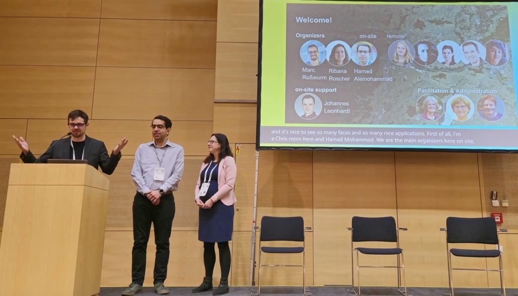
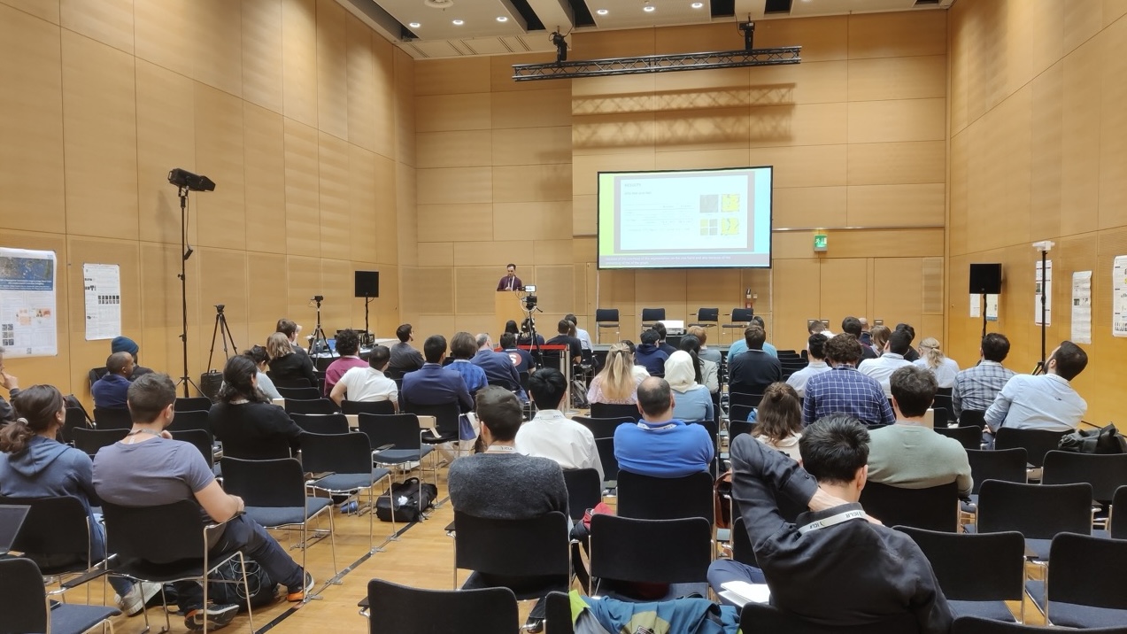
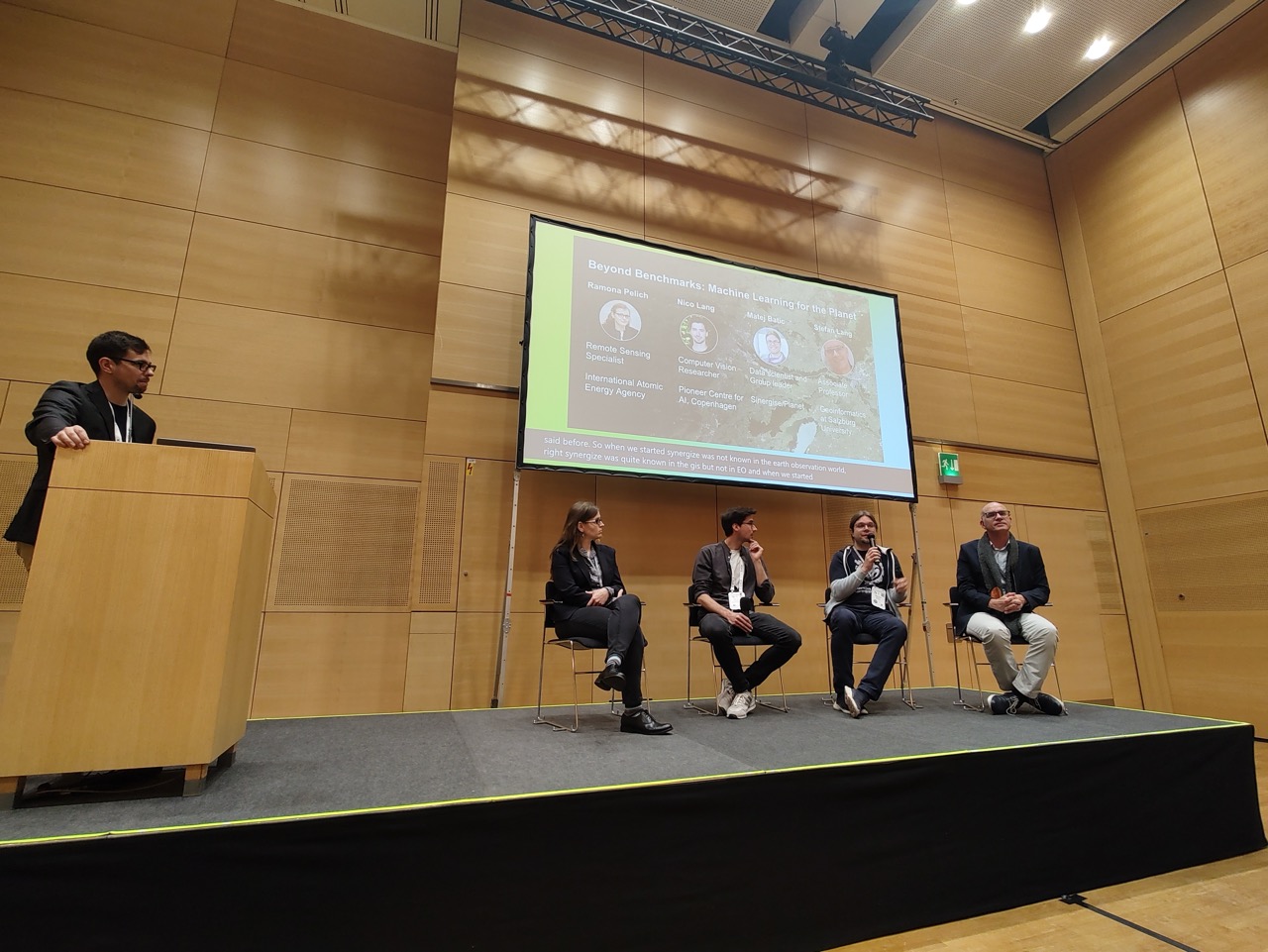
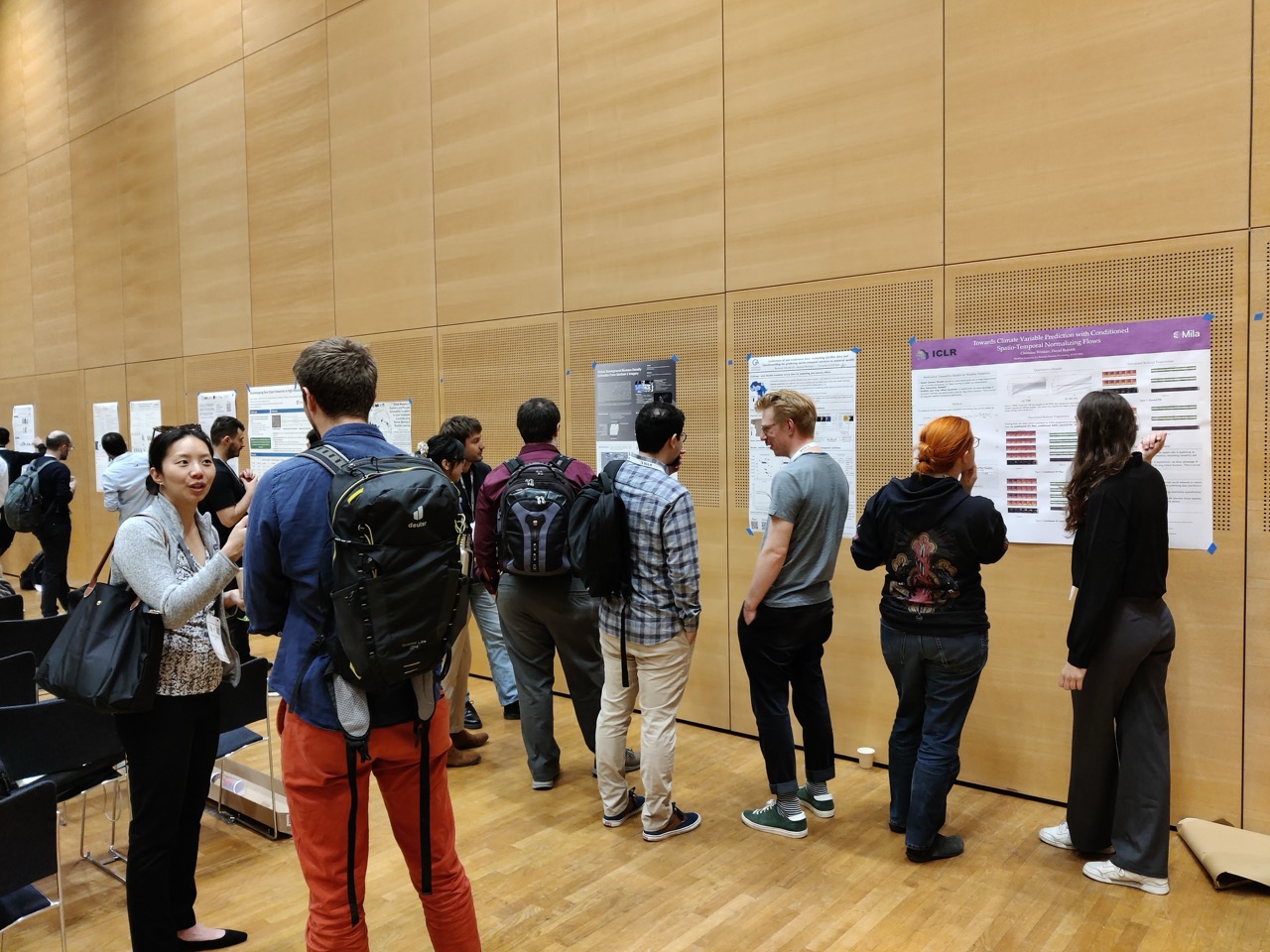
The workshop took place in Vienna on May 11th 2024. Here are some impressions from the Venue.
 |
 |
 |
 |
Awards
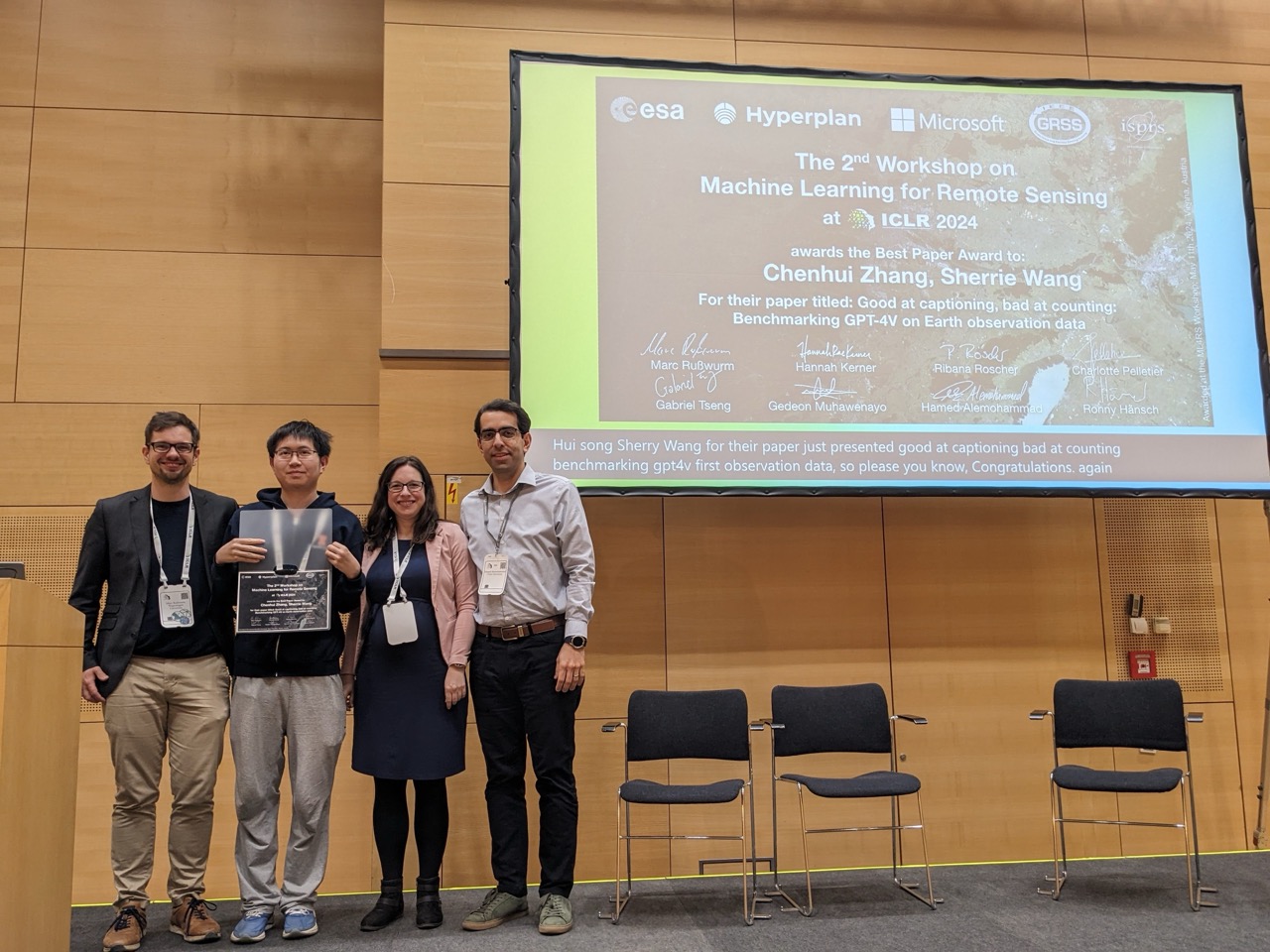
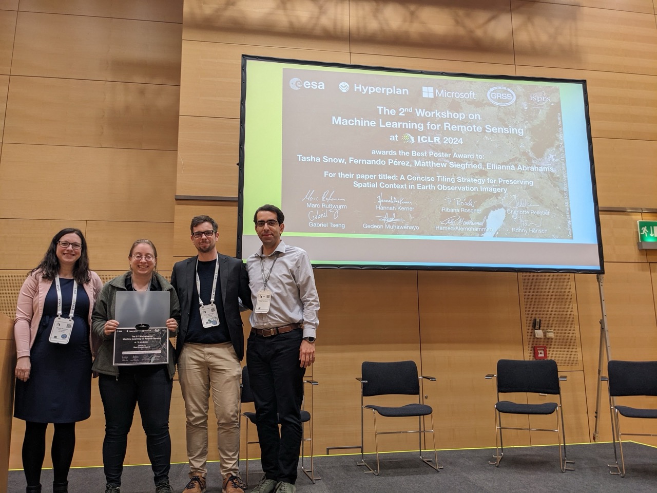
Thanks to our sponsors, we could award the best paper and best poster.
| Best Paper Award | Best Poster Award |
|---|---|
| Good at captioning, bad at counting: Benchmarking GPT-4V on Earth observation data. Zhang, Chenhui; Wang, Sherrie | A Concise Tiling Strategy for Preserving Spatial Context in Earth Observation Imagery. Abrahams, Ellianna; Snow, Tasha; Pérez, Fernando; Siegfried, Matthew |
 |
 |
Schedule
Location Workshop 9 - Room Lehar 4
| Time | Topic |
|---|---|
| 9:00-9:05 | Introduction and Opening Remarks |
| 9:05-9:30 | Keynote Speaker #1: Sherrie Wang (MIT) |
| 9:30-10:00 | Coffee Break #1 (possibility to set up posters with initial discussions) |
| 10:00-11:15 | Poster Session #1 |
| 11:15-12:15 | Panel - Beyond Benchmarks: Machine Learning for the Planet |
| 12:15-12:45 | 2 x Orals #1 |
| 12:45-14:00 | Lunch Break |
| 14:00-14:30 | Keynote Speaker #2: Damian Borth (Univ. St Gallen) |
| 14:30-15:00 | 2 x Orals #2 |
| 15:00-16:00 | Poster Session & Coffee Break #2 |
| 16:00-16:45 | 3 x Orals #3 |
| 16:45-17:00 | Closing Remarks and Best Poster/Paper Awards |
Orals
Orals #1 (12:15-12:45)
- Causal Graph Neural Networks for Wildfire Danger Prediction. Zhao, Shan; Prapas, Ioannis; Karasante, Ilektra; Xiong, Zhitong; Papoutsis, Ioannis; Camps-Valls, Gustau; Zhu, Xiaoxiang.
- Sparsely Labeled Land Cover Classification with Oversegmentation-based Graph U-Nets. Leonhardt, Johannes; Roscher, Ribana
Orals #2 (14:30-15:00)
- Uncertainty Aware Tropical Cyclone Wind Speed Estimation from Satellite Data. Lehmann, Nils; Gottschling, Nina Maria; Depeweg, Stefan; Nalisnick, Eric
- CromSS: Cross-modal pre-training with noisy labels for remote sensing image segmentation. Liu, Chenying; Albrecht, Conrad M; Wang, Yi; Zhu, Xiaoxiang
Orals #3 (16:00-16:50)
- Leveraging Synthetic Data and Machine Learning for Cloud Optical Thickness Estimation. Pirinen, Aleksis; Abid, Nosheen; Kovács, György; Ronald, Scheirer; Ceccobello, Chiara; Agues, Nuria; Ohlson, Thomas; Persson, Anders; Liwicki, Marcus
- Good at captioning, bad at counting: Benchmarking GPT-4V on Earth observation data. Zhang, Chenhui; Wang, Sherrie
- Evaluating Tool-Augmented Agents in Remote Sensing Platforms. Singh, Simranjit; Fore, Michael; Stamoulis, Dimitrios
Posters
Presented in Poster Sessions #1 (10:00 - 11:15) & #2 (15:00 - 16:00)
- [poster] Learned Embedding Fields for Multi-Source, Multi-Temporal Earth Observation Imagery. Brown, Christopher F; Kazmierski, Michal R; Rucklidge, William J; Pasquarella, Valerie J.; Shelhamer, Evan
- [poster] GIMI: A Geographical Generalizable Image-to-Image Search Engine with Location-explicit Contrastive Embedding. Li, Hao; Wang, Jiapan; Teuscher, Balthasar; Luo, Peng; Hong, Danfeng; Mai, Gengchen; Werner, Martin
- [poster] Uncertainty quantification for probabilistic machine learning in earth observation using conformal prediction. Singh, Geethen, Tamara B. Robinson, Glenn Moncrieff, Zander S. Venter, Kerry-Cawse Nicholson, Jasper Slingsby
- Super-resolution of Sentinel-1 Imagery Using an Enhanced Attention Network and Real Ground Truth Data. Ayala, Christian; Amieva, Juan Francisco; Galar, Mikel
- Multi-stage semantic segmentation to map small and sparsely distributed habitats. van der Plas, Thijs Lambik; Geikie, Simon; Alexander, David; Simms, Daniel
- [poster] Noise2Noise Denoising of CRISM Hyperspectral Data. Platt, Robert; John, Cedric; Arcucci, Rossella
- A Concise Tiling Strategy for Preserving Spatial Context in Earth Observation Imagery. Abrahams, Ellianna; Snow, Tasha; Pérez, Fernando; Siegfried, Matthew
- [poster] Impact of Missing Views in Multi-view Model Predictions for Vegetation Applications. Mena, Francisco; Arenas, Diego; Nuske, Marlon; Dengel, Andreas
- Integrating physics deductive biases into learning for hyperspectral classification. Thoreau, Romain*
- [poster] AI-powered School Mapping and Connectivity Status Prediction using Earth Observation. Doerksen, Kelsey; Tingzon, Isabelle; Kim, Dohyung
- [poster] Towards general deep-learning-based tree instance segmentation models. Henrich, Jonathan; van Delden, Jan
- Composite Augmentations for Semantic Segmentation in Aerial Images with Few Samples. Chandramouli, Pranav; Stavness, Ian ; McLoughlin, Phillip; Neufeld, Branden
- On the Relevance of SAR and Optical Modalities in Deep Learning based Data Fusion. Gawlikowski, Jakob; Gottschling, Nina Maria
- Red Teaming Models for Hyperspectral Image Analysis Using Explainable AI. Zaigrajew, Vladimir; Baniecki, Hubert; Tulczyjew, Lukasz; Wijata, Agata Maria; Nalepa, Jakub; Longepe, Nicolas; Biecek, Przemyslaw
- [poster] Leveraging 3d Model Imagery To Estimate A New Window View Index. Law, Stephen; Stalder, Steven; Suel, Esra; Takizawa, Atsushi
- [poster] High-resolution Multi-spectral Image Guided DEM Super-resolution using Sinkhorn Regularized Adversarial Network. Paul, Subhajit; Gupta, Ashutosh
- [poster] Efficient Remote Sensing with Harmonized Transfer Learning and Modality Alignment. Huang, Tengjun*
- [poster] Exploring selective simple image matching methods for Unsupervised Domain adaptation of urban canopy cover and height prediction. Francis, John; Law, Stephen
- Impacts of Color and Texture Distortions on Earth Observation Data in Deep Learning. Willbo, Martin; Pirinen, Aleksis; Martinsson, John; Listo Zec, Edvin; Mogren, Olof; Nilsson, Mikael
- Towards Climate Variable Prediction with Conditioned Spatio-Temporal Normalizing Flows. Winkler, Christina Elisabeth; Rolnick, David
- Limitations of non-traditional data: evaluating satellite data and OpenStreetMap for predicting spatio-temporal variation in material wealth. Schmidt-Ott, Nathanael; Kis-Katos, Krisztina
- Global Above-Ground Biomass Density Estimation from Sentinel-2 Imagery. Bereczky, Max; Hei, Ka ; Rashkovetsky, Dima; Gottfriedsen, Julia*
- [poster] A Change Detection Reality Check. Corley, Isaac A; Robinson, Caleb; Ortiz, Anthony
- [poster] Global Mapping of Exposure and Physical Vulnerability Dynamics in Least Developed Countries using Remote Sensing and Machine Learning. Dimasaka, Joshua T; Emily So; Christian Geiß
- [poster] Bootstrapping Rare Object Detection in High-Resolution Satellite Imagery. Zaytar, Akram; Robinson, Caleb; Quentin Hacheme, Gilles; Tadesse, Girmaw Abebe; Dodhia, Rahul ; Lavista Ferres, Juan M
- [poster] ESO: Evolutionary Spectrogram Optimisation for Passive Acoustic Monitoring. Çakır, Ufuk; Jeantet, Lorène LJ; Lontsi Sob, Aaron Joel A J; Dufourq, Emmanuel
- Spatiotemporal Rockfall Detection Using Point-Based Neural Networks. Zoumpekas, Thanasis; Puig, Anna; Salamó, Maria
- [poster] Leveraging Deep Learning for the Reconstruction of Plant Hyperspectral Data from RGB Images. Sarkis, Serge; Issa, Ibrahim; Abou Jaoude, Dany; Talhouk, Salma
- [poster] Learning Source Domain Representations for Electro-Optical to SAR Transfer. Zeng, Boya; Hussing, Marcel; Eaton, Eric
- Region-Level Labels In Ice Charts Can Produce Pixel-Level Segmentation For Sea Ice Types. Patel, Muhammed; Chen, Xinwei; Xu, Linlin; Chen, Yuhao; Scott, K Andrea; Clausi, David A
- [poster] Spatially Far, Ecologically Close: Evaluating Extrapolation on Vegetation Forecasting Models. Robin, Claire; Weynants, Melanie; Benson, Vitus; Rußwurm, Marc; Carvalhais, Nuno; Reichstein, Markus
- Seeing Through the Clouds: Cloud Gap Imputation with Prithvi Foundation Model. Godwin, Denys; Li, Hanxi; Cecil, Michael; Alemohammad, Hamed
- [poster] Encoding Agent Trajectories as Representations with Sequence Transformers. Tsiligkaridis, Athanasios; Li, Zhongheng; Hou, Elizabeth
- Synthetic data augmentation for earth observation object detection tasks. Khammari, Syrine; Fernández-Laguilhoat Sánchez-Biezma , Enrique; Sukhanov , Sergey ; Tankoyeu, Ivan
- [poster] A Benchmark For Geographic Distribution Shift In Smallholder Agroforestry: Do Foundation Models Improve Ood Generalization?. Sachdeva, Siddharth; Biradar, Chandrasekhar; Lopez, Isabel; Lobell, David
- Physics Informed Modeling of Ecosystem Respiration via Dynamic Mode Decomposition with Control Input. Shadaydeh, Maha; Denzler, Joachim; Migliavacca, Mirco
Keynote speakers


- Sherrie Wang is an Assistant Professor at MIT. She uses novel data and computational algorithms to monitor our planet and enable sustainable development. Her focus is on improving agricultural management and mitigating climate change, especially in low- or middle-income regions of the world.
- Damian Borth is the chair of Artificial Intelligence and Machine Learning at the University of St. Gallen, Switzerland, and covers the area of deep neural networks. His research focuses on representation learning through supervised and unsupervised approaches with applications to computer vision, remote sensing, text-to-speech synthesis, and financial time-series data.
Panelists


Beyond Benchmarks: Machine Learning for the Planet
- Ramona Pelich is a remote-sensing scientist at the International Atomic Energy Agency in Vienna, which monitors nuclear facilities around the globe with remote-sensing data. She can share her experience in the potential of integrating modern machine learning methods in monitoring nuclear facilities remotely across the world.
- Matej Batic is the group leader and data scientist at Sinergise and EO-research group at Sinergise, trying to employ the power of Sentinel-Hub. He has over ten years of experience in both research and commercial projects related to large amounts of geospatial data.
- Nico Lang is a postdoctoral researcher at the Pioneer Centre for AI in the Department of Computer Science, University of Copenhagen, Denmark. He recently published a global-scale data product on tree canopy height at Nature Ecology & Evolution that uses an uncertainty quantifying neural network in combination with satellite-based LiDAR remote sensing. He will share his experiences understanding and adapting lessons learned in modern machine learning to global-scale data products that are used by ecologists on a daily basis.
- Stefan Lang is an Associate Professor at the Department of Geoinformatics at Salzburg University. His vision is to enhance technical and organizational capacities with cutting-edge technological advancements at the interface of satellite Earth observation, geoinformatics, and machine learning. He will share his experiences in integrating modern machine learning in his work with Doctors Without Borders in developing countries.
Organizers
- Marc Rußwurm (Wageningen University)
- Hannah Kerner (Arizona State University)
- Ribana Roscher (Forschungszentrum Jülich)
- Charlotte Pelletier (Université Bretagne Sud)
- Gabriel Tseng (McGill / Mila - Quebec AI institute)
- Gedeon Muhawenayo (Arizona State University)
- Hamed Alemohammad (Clark University, previously Radiant Earth Foundation)
- Ronny Hänsch (German Aerospace Center (DLR) / GRSS)
Program Committee
We thank the program committee for being available to review the submitted papers!
- Alejandro Coca-Castro (The Alan Turing Institute)
- Anthony Ortiz (Microsoft)
- Anthony Vodacek (Rochester Institute of Technology)
- Bertrand Le Saux (ESA / Phi-lab)
- Caleb Robinson (Microsoft AI for Good Research Lab)
- Camille Kurtz (Universite Paris Cite)
- Caroline Gevaert (University of Twente)
- Claudia Paris (University of Twente)
- Claudio Persello (University of Twente)
- Dana Moukheiber (MIT)
- Devis Tuia (EPFL)
- Diego Marcos (Inria)
- Dino Ienco (INRAE)
- Emanuele Dalsasso (EPFL)
- Esther Rolf (Harvard & CU Boulder)
- Gencer Sumbul (EPFL)
- Jefersson dos Santos (University of Sheffield)
- Jan Dirk Wegner (University of Zurich)
- Damien Robert (University of Zurich)
- Emilia Arens (University of Zurich)
- Kaan Karaman (University of Zurich)
- Johannes Dollinger (University of Zurich)
- Marc Katzenmaier (University of Zurich)
- Javiera Castillo Navarro (EPFL)
- Konstantin Klemmer (Microsoft Research)
- Keiller Nogueira (University of Stirling)
- Kristof Van Tricht (VITO)
- Loic Landrieu (ENPC)
- Maja Schneider (Technical University of Munich)
- Mariana Belgiu (University of Twente)
- Mark Wronkiewicz (Jet Propulsion Laboratory)
- Patrick Ebel (ESA)
- Qiusheng Wu (University of Tennessee, Knoxville)
- Roberto Interdonato (CIRAD)
- Rosa Aguilar (University of Twente)
- Sergii Skakun (University of Maryland)
- Subit Chakrabarti (Cloud To Street)
- Sylvain Lobry (Universite Paris Cite)
- Vivien Sainte Fare Garnot (University of Zurich)
- Zhuangfang Yi (Regrow)
Sponsors
We are looking for more sponsors. Please contact us per email if you would like to support this workshop.
Gold Sponsors


Bronce Sponsors

Technical Sponsors

Contact
For questions or information about the Machine Learning for Remote Sensing workshop at ICLR 2024 please contact ml4rs_iclr24@googlegroups.com.


